How to measure distance in Google Maps on Android
By Abu Bakar Saadat · Reviewed by Saadat Rafiq · 2 min read · 3 steps · Published 7 October 2026
Touch and hold the map to drop a red pin, then tap Measure distance in the place card. Drag the map so the circle sits on the next point; the distance updates at the bottom. Tap Add point to measure a path with corners.
- Device
- Android
- Shown on
- Samsung Galaxy A57 5G (SM-A576B), One UI 8.5, Android 16
- App
- Maps
- Real screenshots
- 3 of 3 steps
- Checked
- October 2026
- Sources
- 1 official, linked below
Step by step
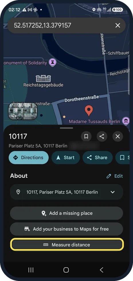
Drop a pin and tap Measure distance
Touch and hold the start point. A red pin appears with the coordinates and the address; we used Pariser Platz in Berlin. Scroll the card and tap Measure distance.
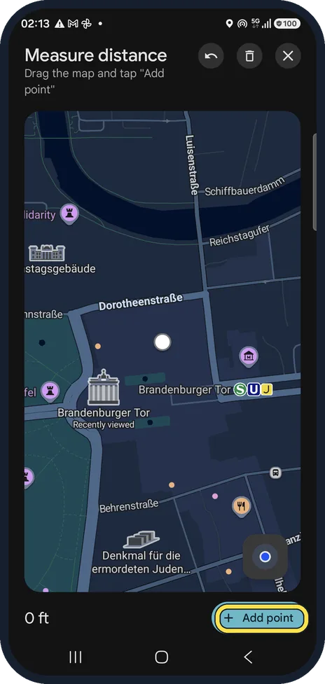
Move the map to the next point
A circle appears in the middle of the screen. Drag the map until the circle is on the next point; a dotted line follows.
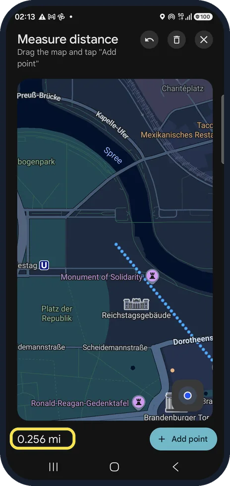
Read the distance
The total is at the bottom left; ours showed 0.256 mi. Tap Add point to set a corner and keep going. The arrow at the top undoes the last point, the bin starts again.
About this guide
Useful for a run, a walk or how far a hotel is from the station in a straight line. The tool is hidden in the dropped pin card.
The screenshots are from Google Maps 26.31.02 on a Samsung Galaxy A57 5G with Android 16 and One UI 8.5, in dark mode. Maps looks the same on other Android phones; only the phone's own Settings screens differ by brand.
Good to know
Our distances were in miles. Distance units in Settings, App & display was set to Automatic and can be changed there.
In short: Touch and hold the map, Measure distance, drag the map, Add point.
Links checked in October 2026. Rules and prices change. Check the official source before you act.
Did this guide work for you?
Sorry about that. What happened?